
We are pleased to announce the publication of the peer-reviewed research article “Vegetation Structure and Disturbance Drivers on a Closed Municipal Solid Waste Landfill in Kokshetau (Akmola Region, Kazakhstan)”, published in Sustainability (MDPI) on 12 February 2026 (Volume 18, Article 1901). The paper is open access under a CC BY license.
This study was developed through international cooperation between researchers from Kokshetau University Named after Sh.Ualikhanov, Universitat Politècnica de València (UPV) (IIAMA), and the University of the Azores, reflecting the LESLIE commitment to evidence-based solutions for environmental management and sustainable land recovery.
 Closed municipal solid waste (MSW) landfills are hotspots of anthropogenic disturbance and can remain environmentally unstable for decades, especially in semi-arid steppe/forest-steppe climates where water limitation, substrate heterogeneity, and ongoing informal dumping constrain ecological recovery. This work provides a first detailed baseline of spontaneous vegetation on a closed MSW landfill near Kokshetau, Kazakhstan, and proposes a restoration-oriented monitoring and target-setting workflow to support phytoremediation and rehabilitation planning.
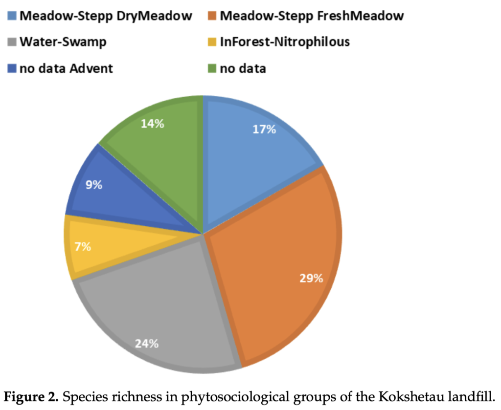
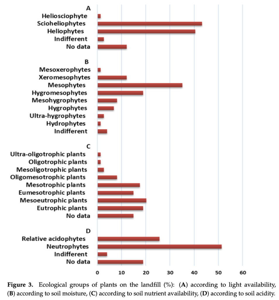
Based on field surveys (August–September 2024) across 12 sampling sites representing actively disturbed zones (ongoing unauthorized dumping) and abandoned sectors, the authors recorded 76 vascular plant species. The plant community was dominated by annual herbaceous taxa typical of disturbed environments, with Asteraceae and Poaceae as the most species-rich families.
The paper translates ecological diagnostics into actionable restoration guidance. It identifies candidate taxa and functional groups for phytoremediation-oriented restoration, while explicitly applying a risk/governance filter (e.g., invasiveness potential, allergenic pollen, and management feasibility). Two dominant species—Artemisia absinthium and Bassia scoparia—are discussed as potential candidates based on in-situ performance and literature-reported traits, while noting limitations (e.g., allergenicity and invasive tendencies, respectively).
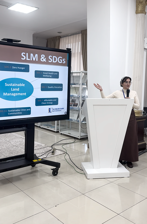
 Overall, the study provides a practical template for monitoring, zoning, and species selection on closed or partially closed landfills in semi-arid steppe regions, supporting the broader LESLIE objective of strengthening applied environmental capacities and sustainable land management approaches.
Reference (as published)
Bayazitova, Z.E.; Safronova, N.M.; Kurmanbayeva, A.S.; Pozsgai, G.; Zhaparova, S.B.; Yessenzholov, B.Kh.; Bogapov, I.M.; Rodrigo-Clavero, M.-E.; Rodrigo-Ilarri, J. (2026). Vegetation Structure and Disturbance Drivers on a Closed Municipal Solid Waste Landfill in Kokshetau (Akmola Region, Kazakhstan). Sustainability, 18, 1901. https://doi.org/10.3390/su18041901
 The
The  The authors explicitly acknowledge the contribution of the Erasmus+ CBHE project LESLIE (ERASMUS-EDU-2023-CBHE No. 101129032) in disseminating the research results, underlining the project’s role in amplifying high-impact scientific outputs and their uptake by stakeholders. The article is published open access under a Creative Commons license (CC BY-NC-ND 4.0).
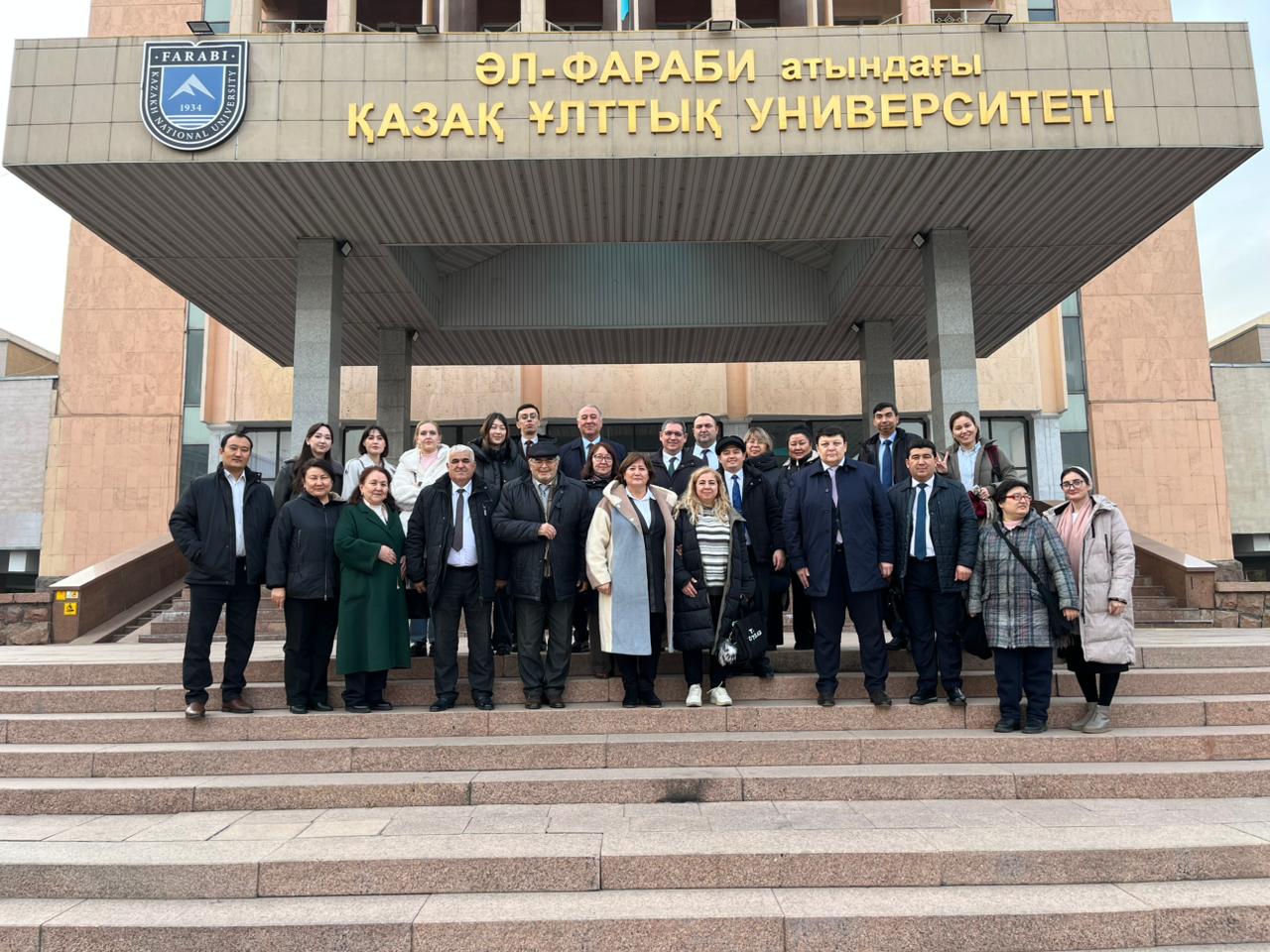
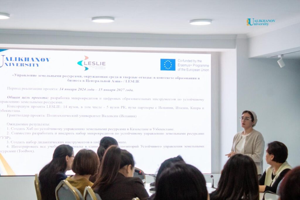
 The meeting gathered EU partners—Universitat Politècnica de València (UPV) as project coordinator, University of Cassino and Southern Lazio (UNICAS), and University of Cyprus (UCY)—together with Kazakh partners (KazNU as national coordinator, Sh. Ualikhanov Kokshetau University (KOKSU), Akhmet Yassawi University (AYU), CAREC, and the Ministry of Science and Higher Education of Kazakhstan) and Uzbek partners (Fergana Polytechnic Institute (FPI) as national coordinator, TIIAME-NRU, BINRM–TIIAME-NRU, Bukhara State University (BSU), International Agricultural University (IAU), and the Ministry of Higher Education, Science and Innovations of the Republic of Uzbekistan).
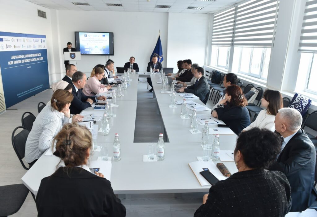
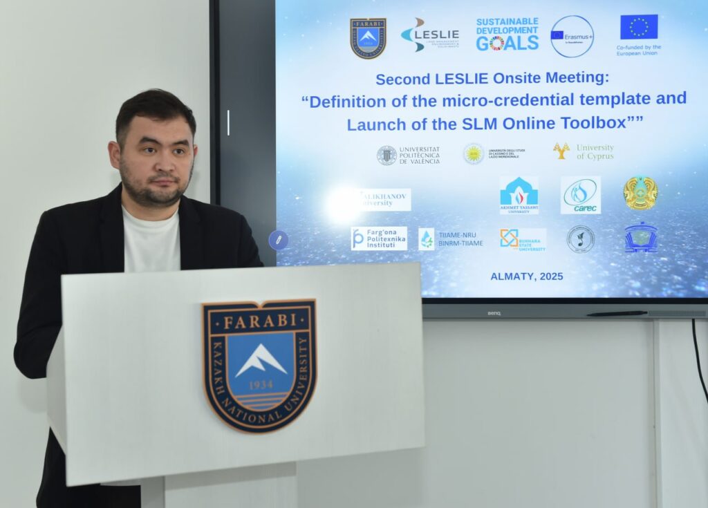 A key technical session followed on micro-qualifications in Kazakhstan, focusing on definitions, conceptual approaches, programme design, and implementation experience, and enabling an open discussion on current challenges for universities when deploying micro-credentials. The afternoon concentrated on project implementation and deliverables.
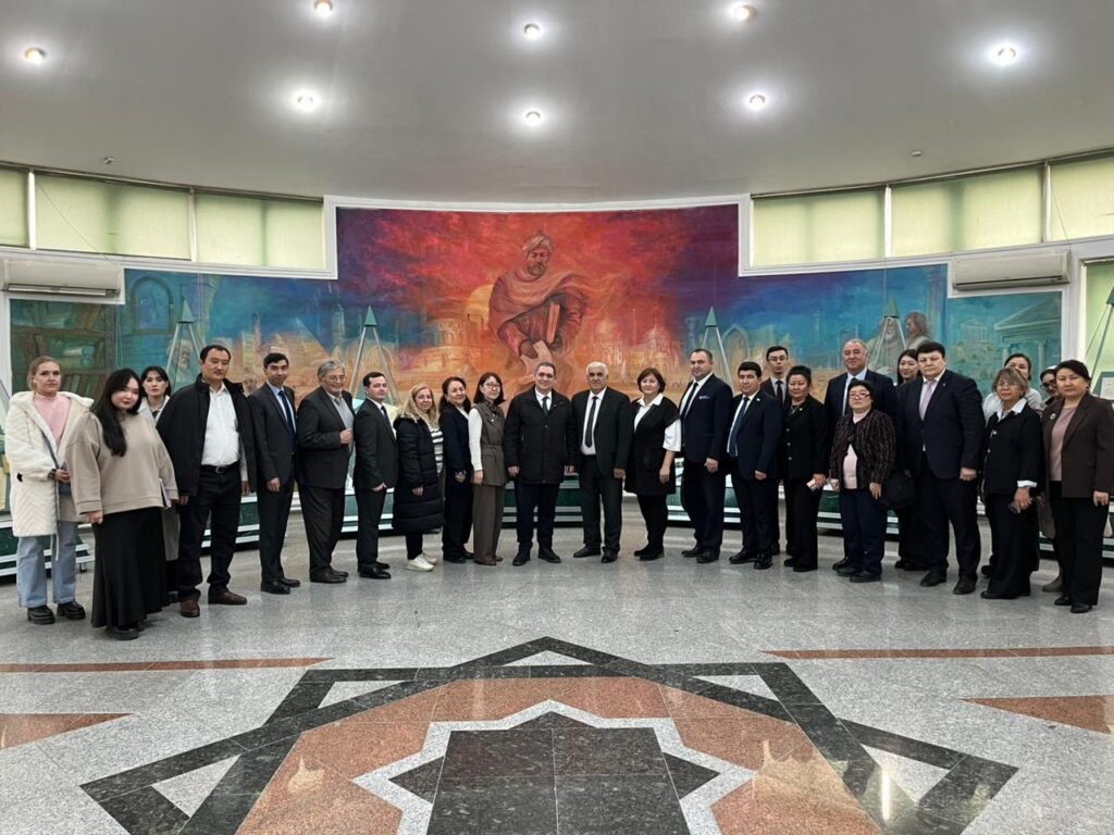 The meeting closed with conclusions and next steps (UPV), followed by a guided KazNU campus tour, supporting networking and a shared understanding of the host university environment.
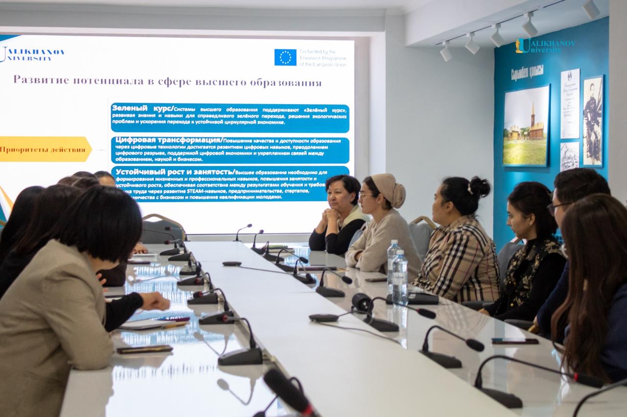

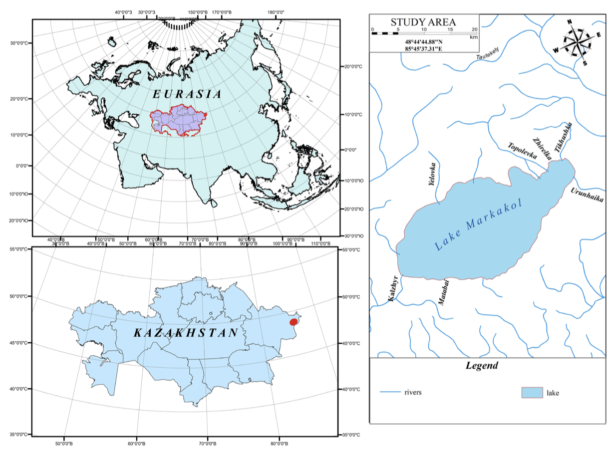
 Researchers from the Department of Meteorology and Hydrology, Faculty of Geography and Environmental Sciences, Al-Farabi Kazakh National University, Almaty, Universitat Politècnica de València (UPV), and other Kazakh institutions have published this joint research study which presents the first centimeter-scale, high-resolution bathymetric model of Lake Markakol (eastern Kazakhstan), generated using advanced hydroacoustic and geospatial techniques.
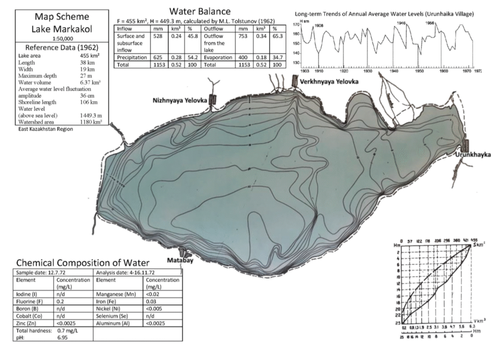
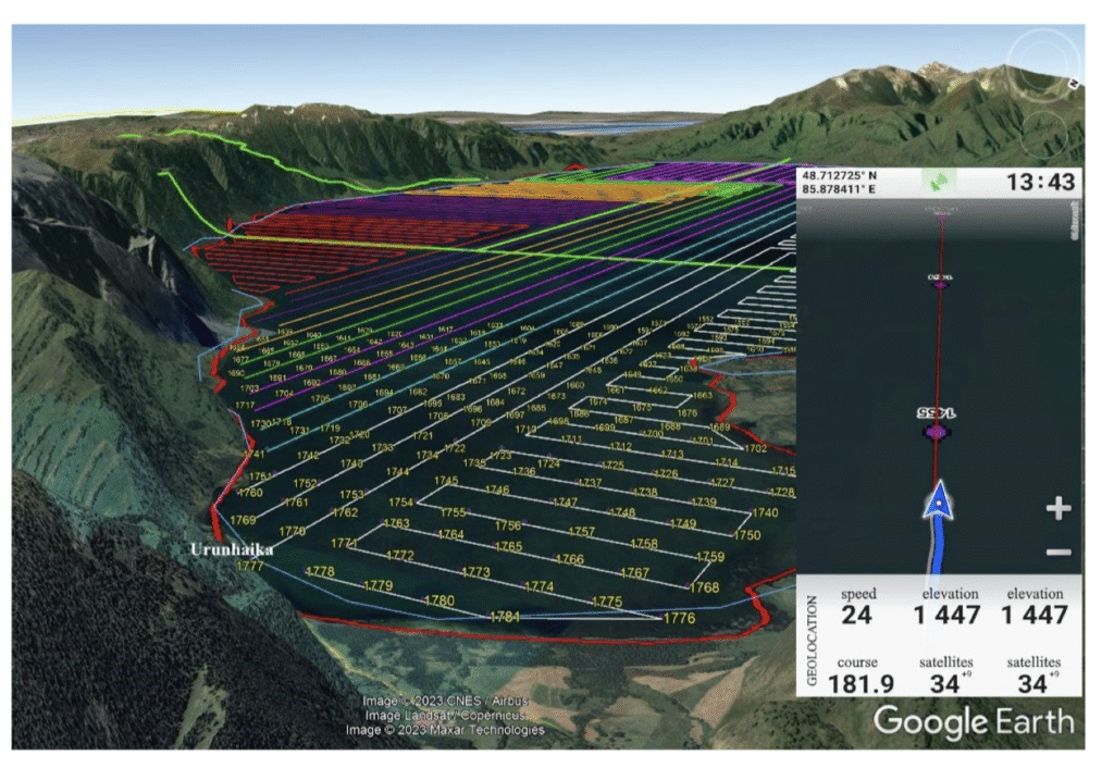 The primary objective was to reassess key morphometric parameters—surface area, depth, volume, and shoreline configuration—more than six decades after the only existing survey from 1962. High-density depth data were acquired with a Lowrance HDS-12 Live echo sounder, achieving vertical precision of ±0.17 m, and processed using ReefMaster and ArcGIS to produce a three-dimensional, hydrologically correct model of the lake basin. Compared with archival data, results show that while the surface area (455.365 ± 0.005 km 2 ), length (38.304 ± 0.002 km), and width (19.138 ± 0.002 km) have remained stable, the maximum depth is lower (24.14 ± 0.17 m vs. 27 m), and the total water volume is slightly higher (6.667 ± 0.025 km 3 vs. 6.37 km 3 ). These differences highlight both the limitations of historical lead-line surveys and the enhanced accuracy of modern hydroacoustic and GIS-based methods.
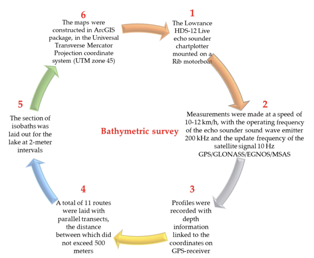 The workflow developed here is transferable to other remote alpine lakes, providing an invaluable baseline for limnological research, ecological assessment, hydrodynamic modeling, and long-term water resource management strategies in data-scarce mountain regions.
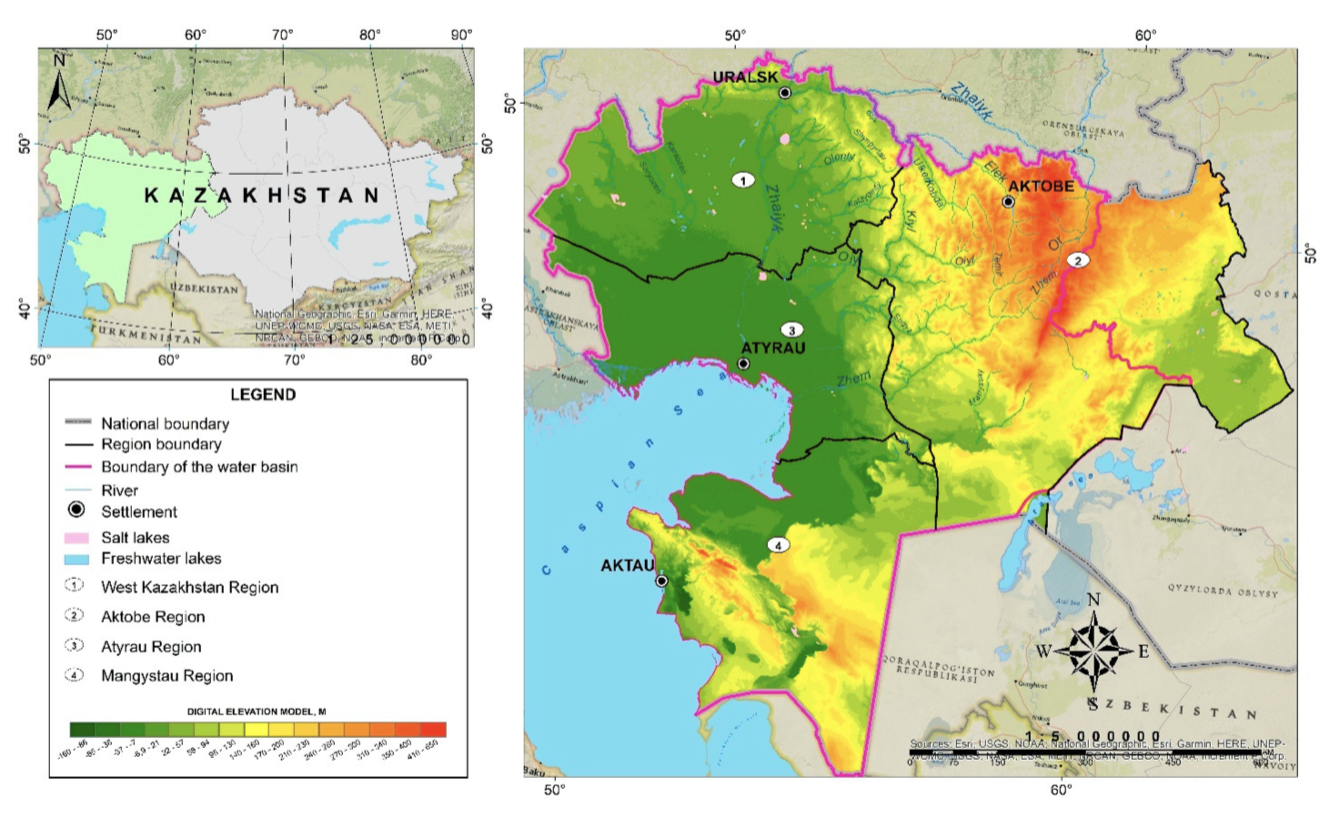
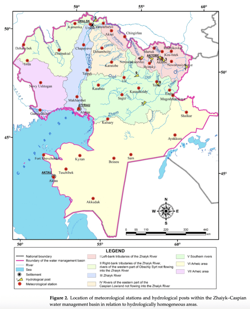 The analysis covers three future time horizons: 2040 (2031–2050), 2060 (2051–2070), and 2080 (2071–2090), under two greenhouse gas concentration scenarios: SSP3-7.0 (moderately high emissions) and SSP5-8.5 (high emissions). The results reveal a pronounced seasonal contrast in the projected hydrological response. During the winter low-water period, a steady increase in minimal runoff is projected for all rivers, with the most significant changes observed for the Or, Zhem, Temir, and Shagan rivers. This increase is primarily driven by higher winter precipitation, increased thaw frequency, and enhanced infiltration recharge. Conversely, despite modest increases in summer–autumn precipitation, minimal runoff during the summer–autumn low-water period is projected to decline significantly, particularly in the southern basins, due to elevated evapotranspiration rates and soil moisture deficits associated with rising air temperatures.
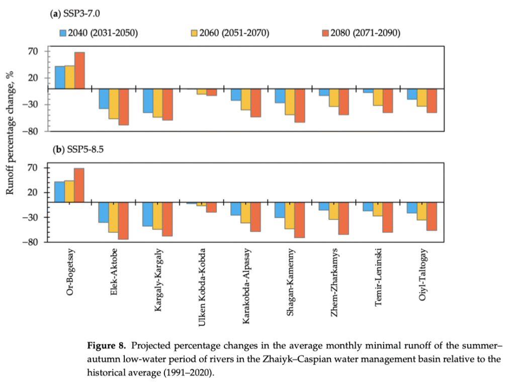
 Research Overview
 An International Research Effort
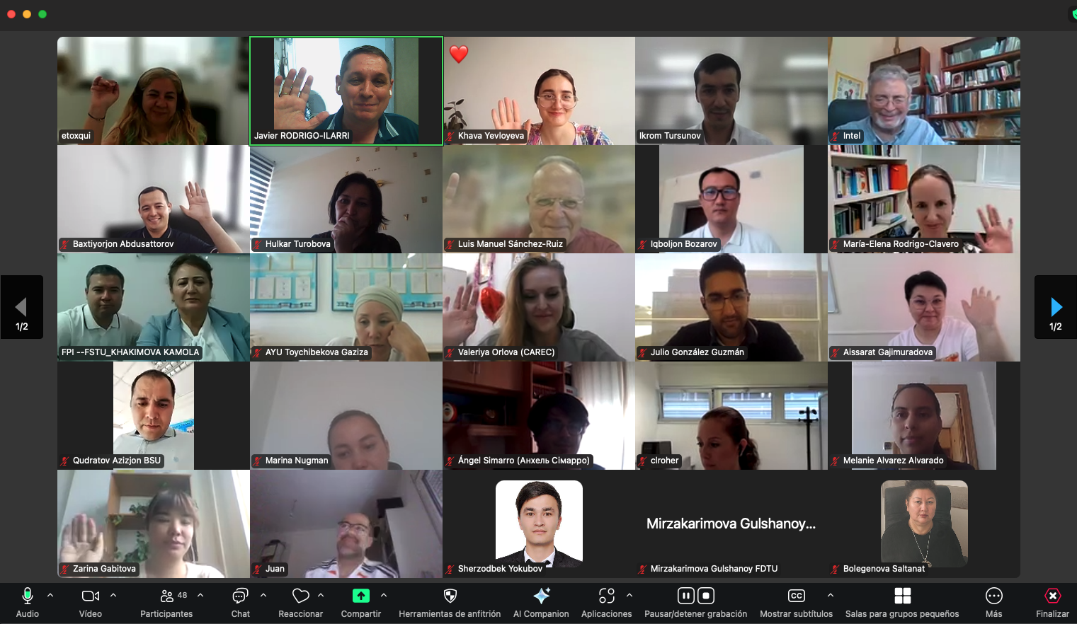
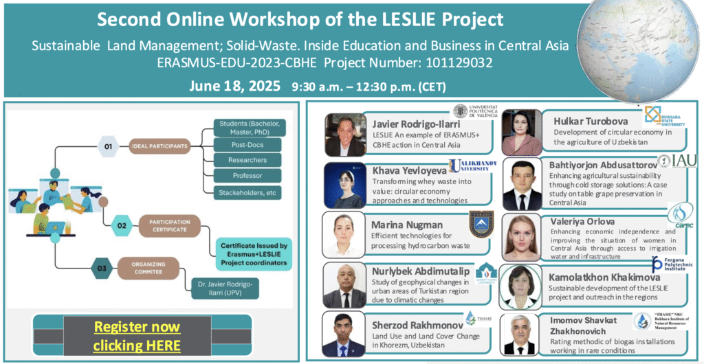 The event was chaired by Javier Rodrigo-Ilarri (UPV) in Part 1, and by Eleni Toxqui (UCY) in Part 2. A highlight was the presentation by Dr. Rodrigo-Ilarri, project coordinator, who outlined the broader scope and achievements of LESLIE as an exemplary Erasmus+ CBHE initiative in the region.
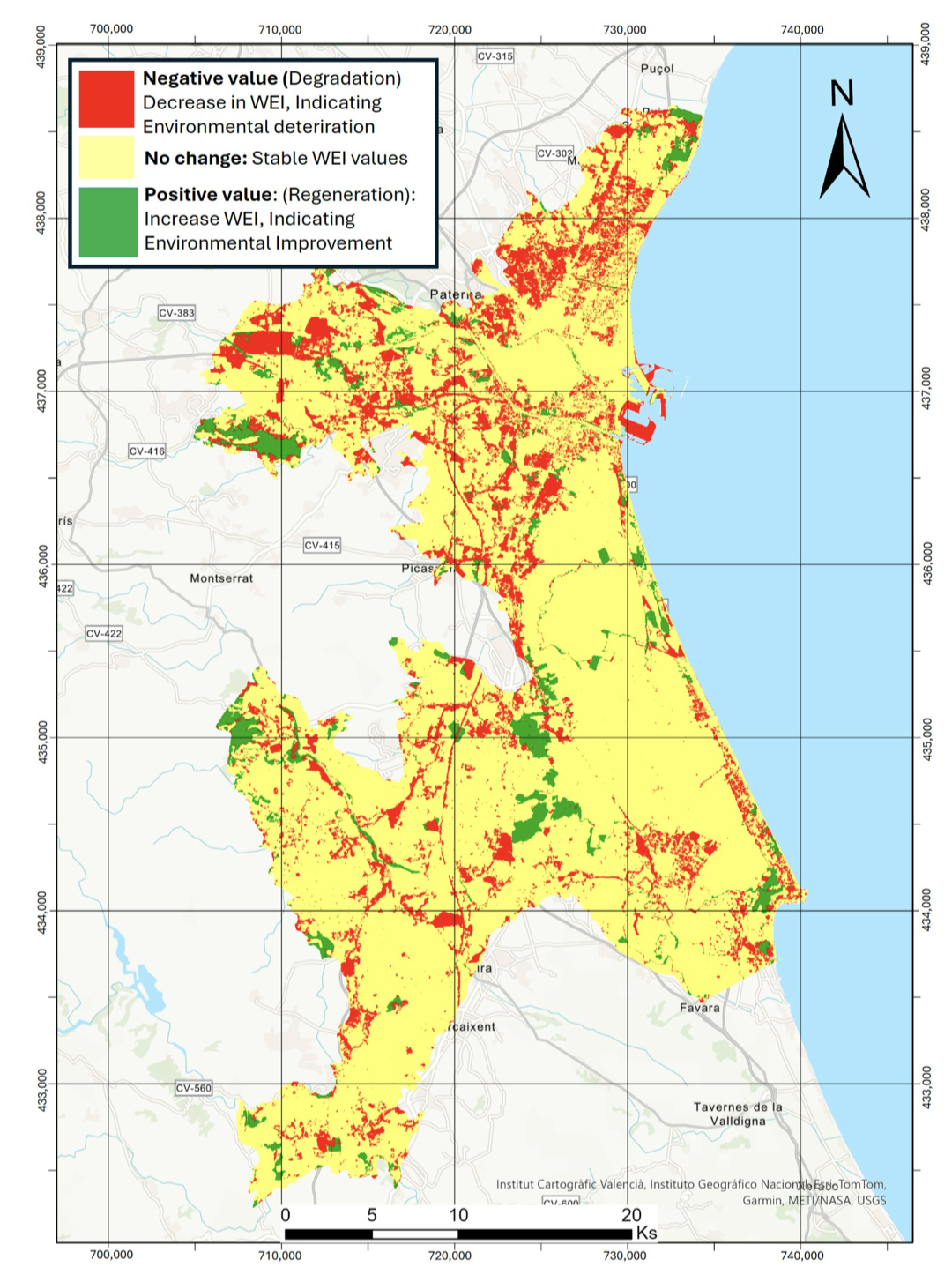
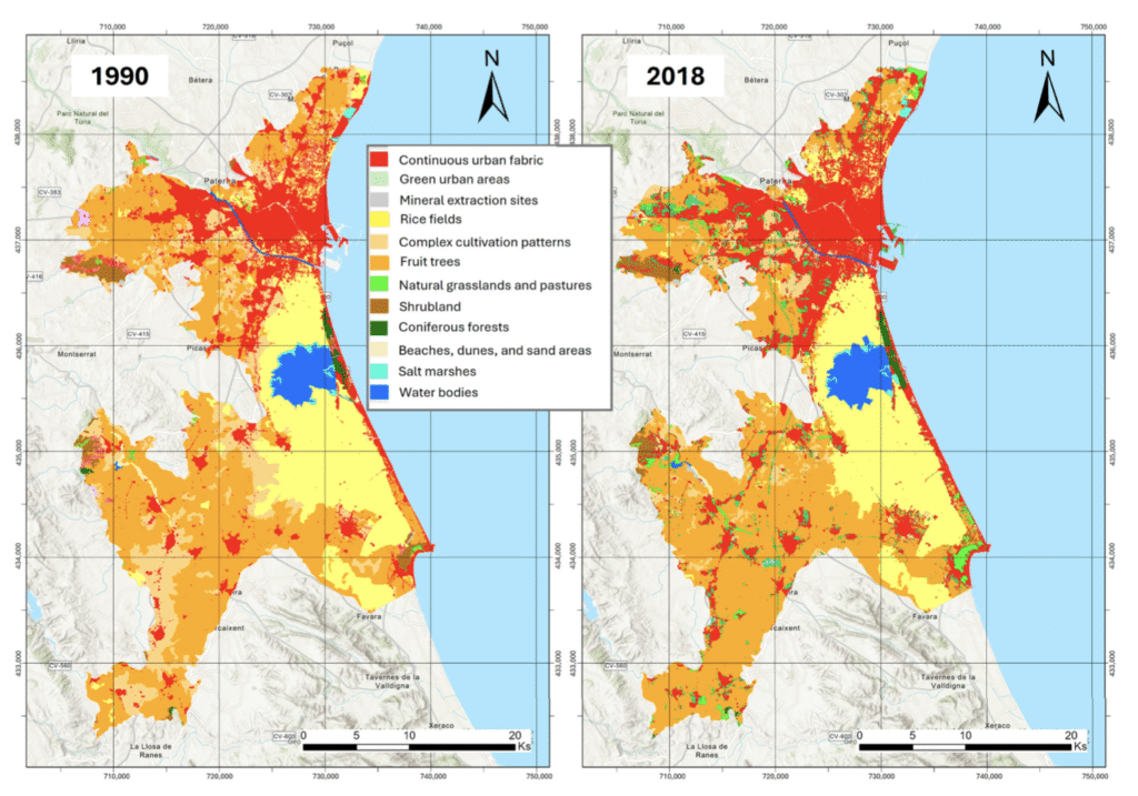 The study also warns of the negative impacts of urban encroachment on the Albufera Natural Park, one of the most ecologically valuable wetlands in the Mediterranean. The combination of urban growth, agricultural intensification, and inadequate spatial planning has reduced the park’s ecological integrity and exacerbated problems such as water pollution and habitat fragmentation.
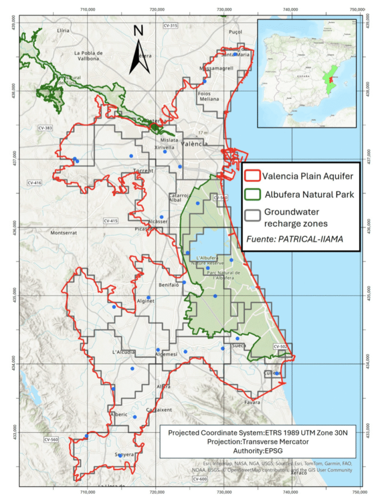 The study demonstrates the usefulness of combining CORINE Land Cover and World Settlement Footprint satellite data to achieve high-resolution environmental assessments. The authors also underline the potential of the WEI as a decision-support tool for sustainable land management in Mediterranean metropolitan regions facing high anthropogenic pressure.