We are pleased to announce the publication of a new scientific paper coauthored by researchers of the LESLIE project partners, entitled: “High-Resolution Bathymetric Survey and Updated Morphometric Analysis of Lake Markakol (Kazakhstan)”, published in Hydrology (MDPI), Volume 2025, Issue 12, (228). The full paper PDF version can be downloaded here.
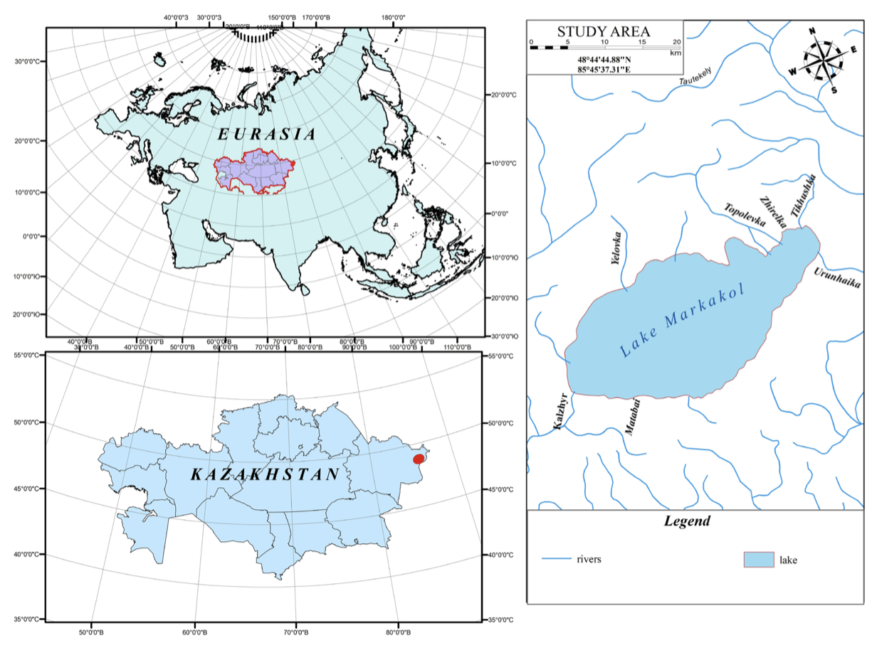
 Researchers from the Department of Meteorology and Hydrology, Faculty of Geography and Environmental Sciences, Al-Farabi Kazakh National University, Almaty, Universitat Politècnica de València (UPV), and other Kazakh institutions have published this joint research study which presents the first centimeter-scale, high-resolution bathymetric model of Lake Markakol (eastern Kazakhstan), generated using advanced hydroacoustic and geospatial techniques.
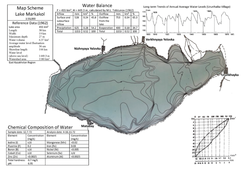
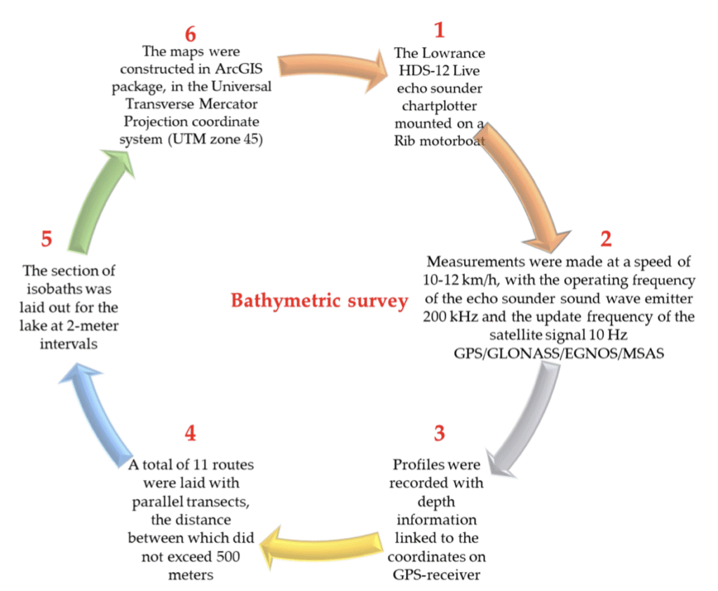
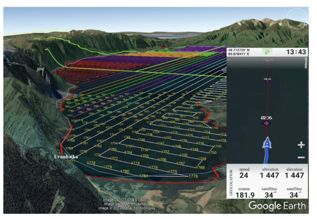 The primary objective was to reassess key morphometric parameters—surface area, depth, volume, and shoreline configuration—more than six decades after the only existing survey from 1962. High-density depth data were acquired with a Lowrance HDS-12 Live echo sounder, achieving vertical precision of ±0.17 m, and processed using ReefMaster and ArcGIS to produce a three-dimensional, hydrologically correct model of the lake basin. Compared with archival data, results show that while the surface area (455.365 ± 0.005 km 2 ), length (38.304 ± 0.002 km), and width (19.138 ± 0.002 km) have remained stable, the maximum depth is lower (24.14 ± 0.17 m vs. 27 m), and the total water volume is slightly higher (6.667 ± 0.025 km 3 vs. 6.37 km 3 ). These differences highlight both the limitations of historical lead-line surveys and the enhanced accuracy of modern hydroacoustic and GIS-based methods.
 The workflow developed here is transferable to other remote alpine lakes, providing an invaluable baseline for limnological research, ecological assessment, hydrodynamic modeling, and long-term water resource management strategies in data-scarce mountain regions.