We are very pleased to share our latest research article, now published in Progress in Disaster Science (Elsevier):
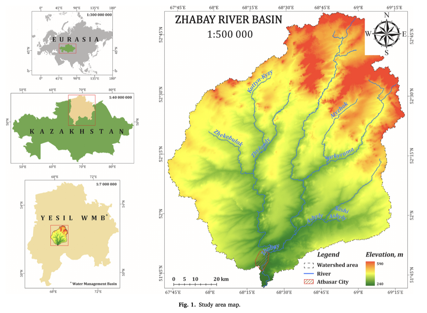
📄 “GIS-based flood risk assessment in the Zhabay River Basin, Kazakhstan”
The study results from an international collaboration between researchers from Al-Farabi Kazakh National University (Almaty – Kazakhstan) and the Universitat Politècnica de València (Valencia – Spain).
🌊 The research develops an integrated GIS-based framework for flood-risk assessment in the Zhabay River Basin, a snow-fed catchment in Kazakhstan where severe spring floods have repeatedly affected Atbasar and surrounding settlements. The methodology combines:
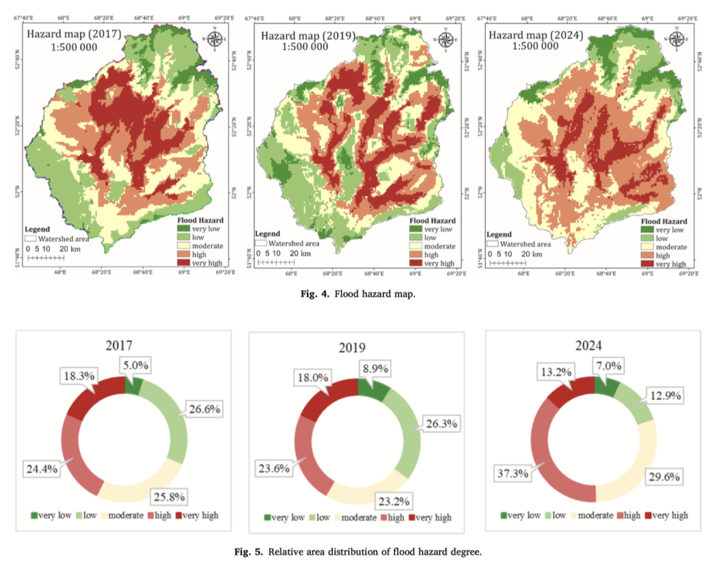
🔹 Flood hazard assessment
🔹 Spatial vulnerability analysis
🔹 GIS-based inundation scenario modelling
🔹 AHP multi-criteria analysis
🔹 Sentinel-2 satellite observations for independent validation
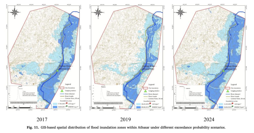 The results are particularly encouraging: validation against observed flood extents produced AUC values of 0.920, 0.820 and 0.906 for the 2017, 2019 and 2024 floods, respectively, confirming the strong predictive capability of the proposed approach.
🛰️ One of the main contributions is the integration of hydrometeorological flood-triggering factors, territorial vulnerability, inundation scenarios and satellite-based verification within a single GIS framework.
This approach is especially relevant for data-scarce, snow-fed river basins and can support better flood-risk management, spatial planning and disaster-risk reduction.
 👏 Congratulations to all the co-authors for this excellent collaborative work!
📚 Progress in Disaster Science, Volume 31 (2026), 100694
🔗 DOI: 10.1016/j.pdisas.2026.100694
🌐 Open Access and available online since 30 August 2026.
#Research #FloodRisk #Hydrology #GIS #RemoteSensing #DisasterRiskReduction #FloodManagement #Kazakhstan #EnvironmentalEngineering #UPV #IIAMA #InternationalCooperation #Science #OpenAccess